The green jewel of Vojvodina - Zagaj Hills
Zagajička (Zagajska) hills represent a landscape on the northeastern edge of Deliblato Sands. They cover a little more than 250 ha and represent the second protection zone within the special nature reserve "Deliblatska peščara".
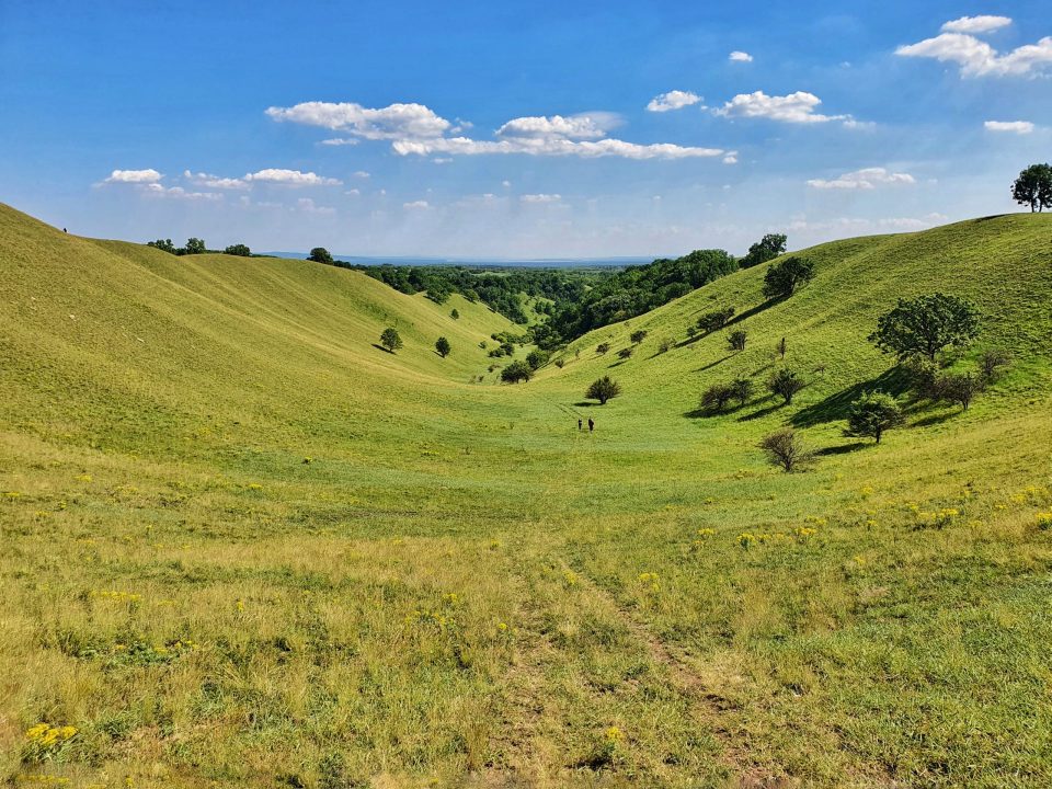
Zagajička hills represent the highest part of Deliblato sands, and according to many, the most beautiful. The view from them stretches for tens, even hundreds of kilometers from all sides. You can see the surrounding places, but also some further places, the Vršac Mountains, the southern Carpathians, as well as the water of the Danube in the distance. Entering the zone of Zagajičke brdi, where the sand dunes are more than 200 m high, you get the feeling that you are in a mountainous area, and not in a flat sandstone. Zagajica hills are hidden between a large area of Deliblato sands and its edge near the village of Zagajica. This is exactly the most attractive part of the Banat sandstone, and it is possible to reach it only on foot and with a good knowledge of the roads. This natural phenomenon is located only 75 km from the capital. Access is possible from three directions. The recommendations are to come to the hills by bike in the spirit of sustainable tourism.

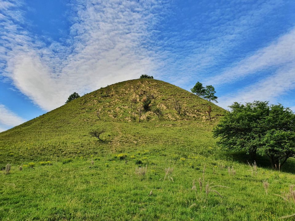
Zagajička hills, which look like ball-shaped hills, are actually ancient sand dunes, partly forested and partly covered with steppe vegetation. These light forms of relief, overgrown with steppe vegetation, represent one of the last preserved steppe landscapes in Vojvodina. The only relic of the proto-landscape of the Pannonian lowlands before it was swallowed by arable land. It is interesting that reeds can still be seen on the slopes of Zagajičke brdi.
Zagajička brda is the habitat of the largest colony of blind dogs in Europe, and other protected species also live there.
At the highest point of the Zagajic hills, there is a monument in the form of a masonry obelisk that protects the point of geodetic survey from the time of Austro-Hungary. Although many claim that the obelisk was erected during the time of Maria Theresa, given the steel reinforcement in the concrete pedestal, it would be safest to date it to the beginning of the 20th century, probably just before the outbreak of the First World War.
A high meteorological column for measuring wind speed was erected next to the obelisk much later.
Zagajička hills are a hidden gem for photographers, and all those who want to become one - a miniature Banat Tuscany! The scenes are most beautiful in mid-May and late October, of course at dawn or dusk, with a gentle play of light along the contours of the hills and through the canopy of wild sandy oaks.


How to get there?
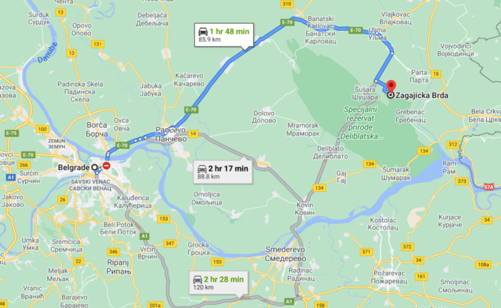
The singularity in the Vojvodina landscape is only 75 kilometers from the capital. Access is possible from three directions. It is best to come to Zagajička brda by bicycle, in the spirit of sustainable tourism.
If you start with children, you should know that riding a bicycle on a dirt road and through dredgers is an interesting but also hard action. It is necessary to master a few shorter climbs, which is a significant effort on this terrain when the weight of the bike reaches 50% of the child's weight.
Via Dolovo, Mramorka and Deliblato, you can reach the visitor center "Chardak" on the southern edge of Deliblato Sands. Further to Shushara, there is a narrow road in the length of 11.5 kilometers, which somewhere in the middle intersects the sandstone itself in the direction from south to north. It is attractive for cycling and inconvenient for ordinary vehicles. Although mostly asphalt, the road is collapsed in many places and full of depressions, some of which are often filled with water.
If you do not plan to drive from Čardak to Šušara, the shortest approach to the Zagajički hills leads to the main road Pancevo - Vršac. It is necessary to turn right in Uljma on the road to Bela Crkva. Shortly afterwards, in Izbište, turn right again towards Šušari. At some point the road climbs the hill and makes a slight curve to the right. Immediately after the ascent and curve, you should leave the car at the first intersection and start the road to Brda by bike or on foot on a field road on the opposite left side of the road. This road is the shortest connection between Zagajičke brdi and an asphalt road, which is 4 kilometers and mostly not lost in height. It is not recommended to drive the mentioned road to the hills by city car!
Source: Wikipedia, nestvarna.blog, www.mojsvetuboji.com


